|
Images are provided as samples only and may not be used without permission.
Full-colour 24 bit image-maps derived from Earth observation satellite data. Images are geocoded in a simple cylindrical projection (latitude-longitude grid) for easy use with other geographic information such as digital maps, gazetteers and terrain models. Basic geographic overlays - country area mask, borders and placenames - are provided to aid orientation. Digital terrain data is also available for the production of 3D graphics and animations.
When viewed at full resolution on a tv screen, global data with a pixel resolution of 1 km will show an area about 700 km or 400 miles across. Our new regional map, with a pixel size of 240 metres, allows you to move in closer to show an area about 180 km or 100 miles across. Colours are consistant with our global Satellite Imagemap data.
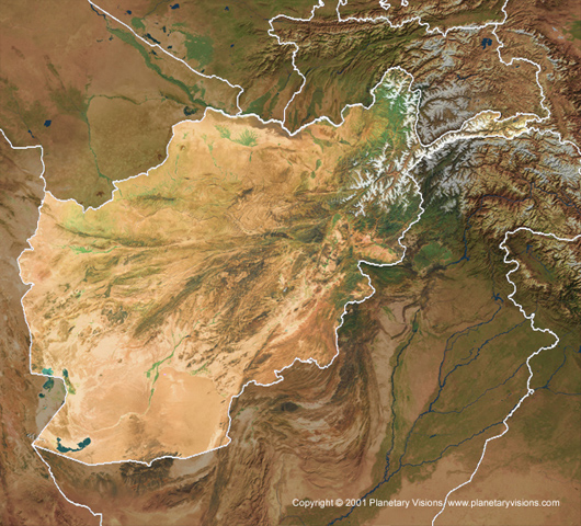
240 metre Satellite Imagemap
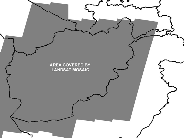
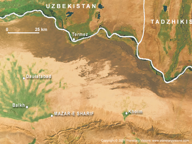
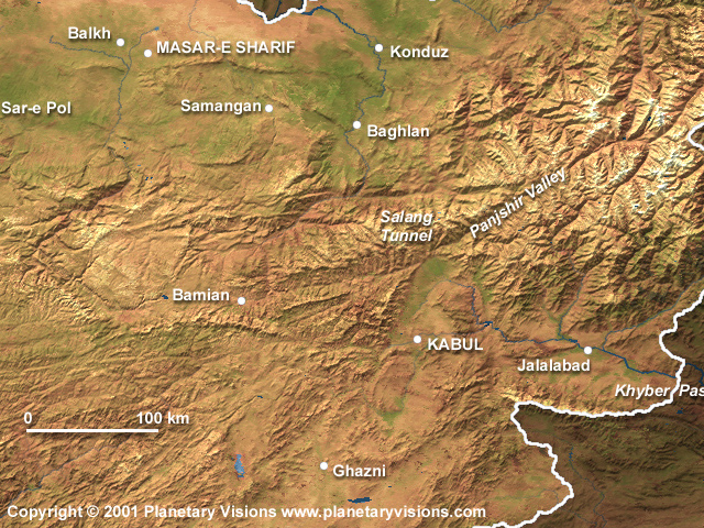
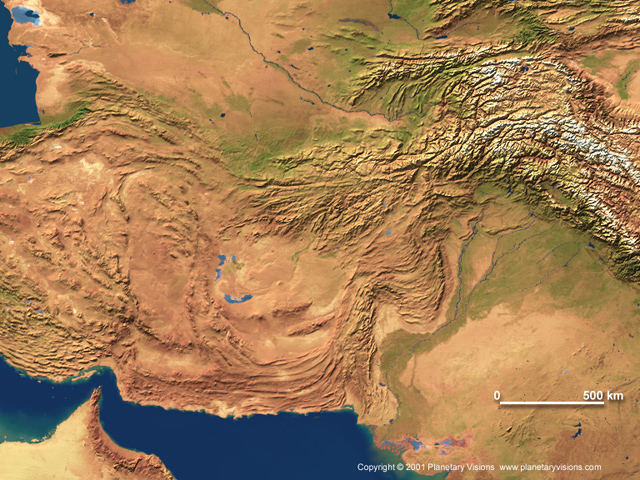
A mosaic of 36 Landsat 7 images from spring-summer 1999-2001. Almost total coverage of the territory of Afghanistan at 240
metres, and a varying distance into neighbouring countries (see coverage map). Hill-shaded, colour-balanced and merged with 1km Satellite Imagemap background.
image size: 6632 x 6000 pixels
extent: 60-76ş East, 28-40ş North
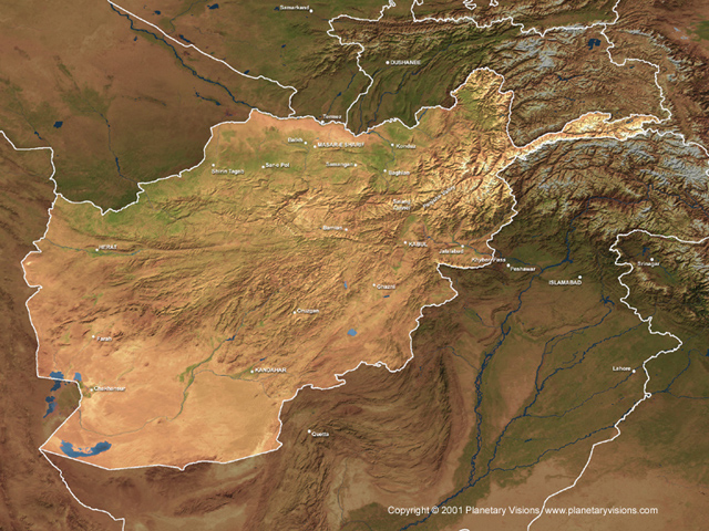
Overview image
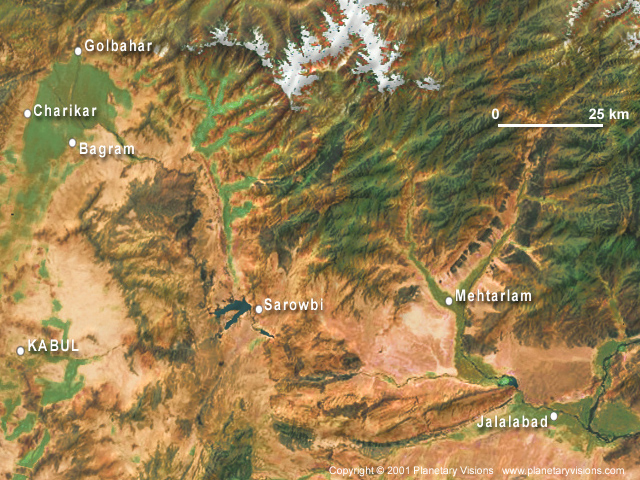
Full-size sample Kabul area
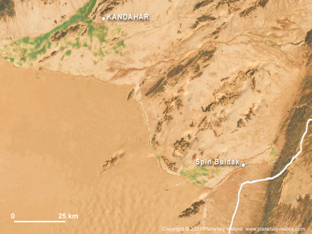
Full-size sample Kandahar area
Full-size sample Masar-e Sharif area
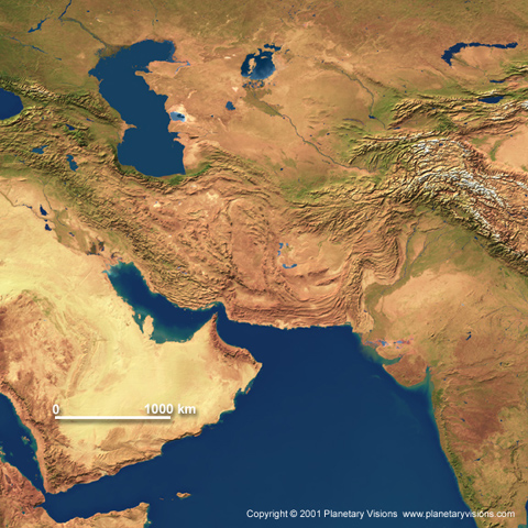
1 km Satellite Imagemap
Extract from our global Satellite Imagemap data, based on NOAA-AVHRR weather satellite imagery, enhanced with hill-shading and
digital map rivers.
image size: 1920 x 1440 pixels
extent: 60-76degE, 28-40degN
Overview image
Full-size sample
4 km Satellite Imagemap
Extract from our global Satellite Imagemap data, based on NOAA-AVHRR weather satellite imagery, enhanced with digital hill-shading.
image size: 1200 x 1200 pixels
extent: 40-80ş East, 10-50ş North
Overview image
Full-size sample
|
